Hasta La Vista

16 April 2010 - Cartegna, Columbia, South America

After an uneventful eight hours of sailing and motoring, we arrived at Cartegna and anchored off the Club Nautico Marina which we found to be very basic with all buildings except for a makeshift office having been pulled down supposedly in the process of rebuilding but we could see little headway made during our stay.
View of Cartegna from “Hasta La Vista” on our arrival.

Cartagena de Indias was founded on 1 June 1533 by Spanish commander Pedro de Heredia, in the former location of the indigenous Caribbean Calamarí village. The town was named after Cartagena, Spain, where most of Heredia's sailors came from.
For more than 275 years, Cartagena was under Spanish rule. On November 11, 1811, Cartagena declared its independence.
Cartegna was the biggest city of the Viceroyalty until 1811, when the Peninsular War, which became a War of Independence and Piñeres's Revolts, marked the beginning of a dramatic decline in all aspects for what had become the virtual capital of New Granada. In 1815 the city was almost destroyed. No census information exists for that time, only accounts of how the city became literally a ghost town. Only around 500 impoverished freed slaves dwelt the city, whose palaces and public buildings became ruins, many with collapsed walls.
Recuperation, though slow, did begin, but then stopped as a result of the general economic and political instability of the country at the time.
Several famines and cholera outbreaks in the mid-1800s decimated the city, and it was in danger of disappearing.
After the 1880’s the city began to recover from crisis and vigorous progress continued, though somewhat slowly, after the 1929 crash. Syrian, Palestinian, Lebanese, Chinese and other immigrant communities developed in this period of time.
Between 1930 and 1970 the city showed great population growth at rates higher than the national average and higher than that of Bogotá, which boomed mainly because of internal displacement and the hope of work opportunities as centralization increased. By 1970, the population spurt was over, but population growth has been dramatic since the 1980’s with a mixture of privatization of the port infrastructure, decentralization of tourism, and, sadly, the fact that proportional to its population, Cartagena is the city that has received the most displaced people from the countryside with the escalation of civil war in the 1990’s in the Andean regions as refugees looked for safety in the Caribbean capital.
Today the city shows a continuing tendency for population growth that began in the mid-80’s. Birth rate and relatively normal death rates feed the ongoing economic expansion.
Cartagena has boasted "modern" urban development in recent years, with the construction of new skyscrapers. As of October 2007, there were 42 high-rises under construction, including an effort to create Colombia's tallest, the Torre de la Escollera, expected to be completed in early 2007, planned to stand at 676 ft (206 m) and having 58 floors. However, real development of the project, assisted by the strong Caribbean winds, led to its dismantling. A new, twenty-story building has been planned instead.
A conversation with a taxi driver informed us that even though Council approval was received for these many highrisers, development of the infrastructure of the city was not considered in context. Today, many residential highrisers are empty because water, sewerage and electricity are lacking.

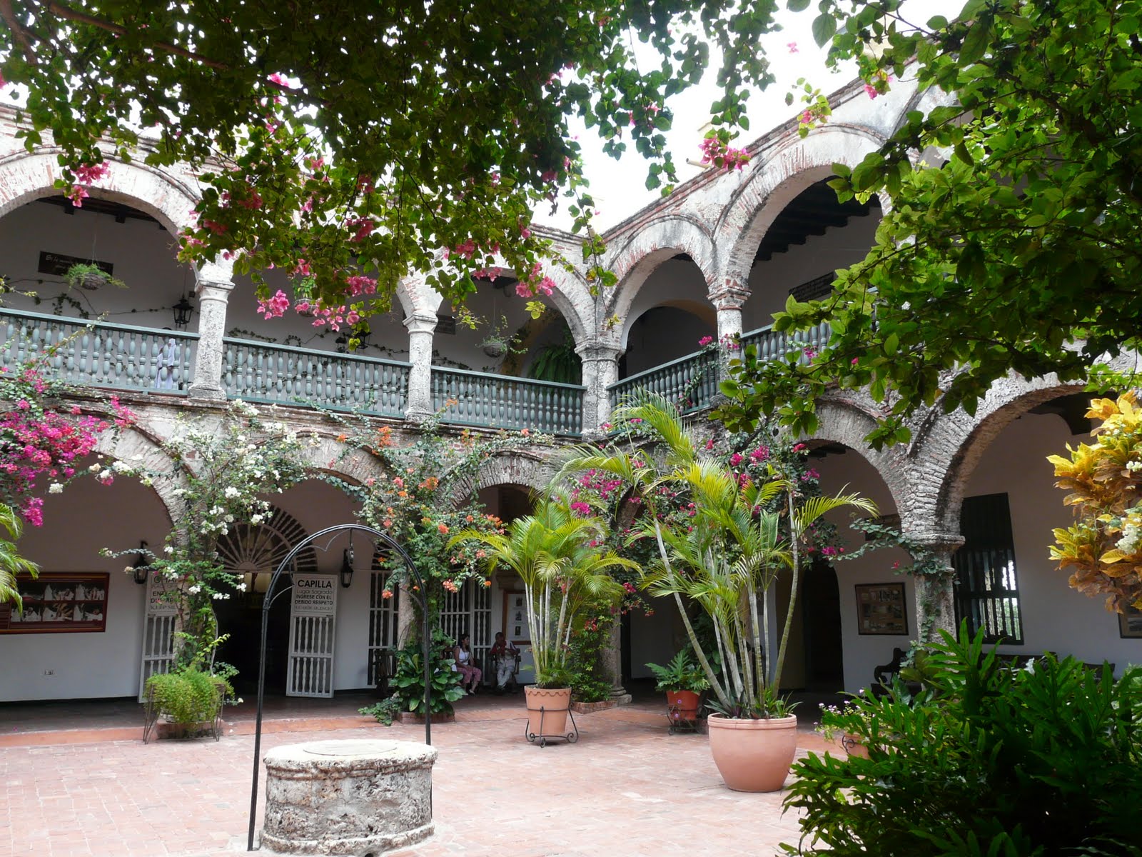
The Downtown area of Cartagena has varied architecture, mainly colonial style and Italian style buildings.
A street in the “Old City” of Cartegna.

Bocagrande (Big Mouth) is a much-sought-after area with many hotels, shops, restaurants, nightclubs and art galleries. It is located between Cartagena Bay to the east and the Caribbean Sea to the west. Its particular appeal is in the beaches and nightlife around Avenida San Martín (Saint Martin Avenue), the backbone of the area.
The beaches of Bocagrande, lying along the northern shore, are muddy. There are breakwaters about every 200 yards, and the azure of the Caribbean is lacking as the beach is very nearly at sea level and there is a lack of proper waste disposal in the city.
Originally constructed for foreign oil workers, Bocagrande consists mostly of land acquired through land reclamation. Bocagrande is now considered the city's most popular area for tourists.
Bocagrande's skyline.

As the busiest container port in the country, and third in grain transportation, the city is well connected with the ports of the Caribbean main, and the rest of the world. The city is served with three open ports, and more than 40 private ports.
One of the many container ships heavily loaded with containers.

The city offers reasonably safe streets, but one always has to be "cautious and aware", friendly people and an array of things to do. The language is Spanish and the currency is pesos. Approximately 2,000 pesos was equal to US$1. It was quite strange working in hundreds of thousands of pesos.
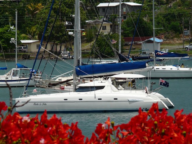
We spent four and a half days in Cartegna and made the most of our short stay exploring the old city and Bocagrande, El Convento de la Popa, which is an old convent established on a mountain overlooking the city and the Museo Naval (The Naval Museum) and of course, the supermarkets and shopping centres to provision for our sail to Colon, Panama. Taxis were cheap and there were many reasonably priced restaurants.
El Convento de la Popa, the 16th Century Covent built on a mountain overlooking Cartegna

At the entrance to El Convento de la Popa, a local had a young sloth on show. Sloths are extremely slow-moving mammals found in the rainforest canopies of Central and South America. There are two species of sloths: two-toed and three-toed. Most sloths are about the size of a small dog and they have short, flat flat heads. Their hair is grayish brown but, at times they look grey-green in colour because they move so slowly that tiny camouflaging algae grow all over their coats. Sloths eat fruit and leaves. We had never seen an animal such as this. I didn’t want to hold the sloth but was convinced to do so. After leaving the area in a taxi, I began to itch and noticed little black insects jumping all over me. It seems that the sloth had fleas!!

Early on 21 April 2010, we set sail for the San Blas Islands, a distance of 180 nautical miles. Winds ranged from 5 knots to 14 and then 22 knots. Our spinnaker and mainsail were hoisted when a gust of wind tore the spinnaker. We rushed out and were able to get it down, dragging some of it in from over the side. The spinnaker was bought second hand in the British Virgin Islands and was very lightweight. We thought that we were set for the Pacific but unfortunately, repairs are going to be needed in Panama.

1 and 2 May 2010 - The Panama Canal

The Panama Canal was carved through one of the narrowest and lowest of the long mountainous isthmus that joins the North and South American Continents. The locks, three on each side, were for a long time the world’s largest concrete structures. They have functioned flawlessly 24/7 for nearly 100 years.
The United States had a monopoly over the Panama Canal for 85 years. However, the Torrijos-Carter Treaties signed in 1977 began the process of returning the canal to the Panamanian government in 1999.
Since the Panamanian Government has taken over the administration of the Canal, fees have increased greatly and it now pumps millions of dollars from toll revenue to the national economy and provides massive employment.
While sightseeing in both Colon and Panama City, Mal and I viewed clusters of vacant buildings, offices, and double story brick homes. Apparently, these were inhabited by the Americans when America was administering the Canal. On leaving, these buildings were abandoned and are still vacant to this day.
There are three optional types of lockages available to vessels under 38 metres (125 feet) length overall when transiting the Canal. They are: Centre Chamber, sidewall or alongside a tug.

Centre Chamber Lockage – This is the preferred type of lockage. The vessel is held in the centre of the chamber by two bow and two stern lines. Often this type of lockage is done “nested”; this means rafting up with one or two other boats in order to form a nest of two or three boats. Yachts tie up to one another just before entering the locks and split up once they have transited the set of locks.

Sidewall Lockage – This type of lockage uses two of the required 125ft lines to hold the vessel alongside one sidewall in the chamber. The walls of the locks are rough unfinished concrete, which can cause considerable damage to vessels not properly protected by fenders. Damage to masts or rigging on sailboats may also occur if turbulence causes the vessel to roll and strike the sidewall. Consequently, sidewall lockage is not recommended for small yachts, except on downward lockages, when turbulence and currents are much less pronounced.

Alongside a tug – This type of lockage, when available, also uses two of the required 125ft lines. Availability of this type of lockage depends on the ship traffic for the day, and as such cannot be scheduled in advance. The vessel waits for the tugboat to tie to the sidewall of the lock. Once the tug has secured itself to the sidewall of the lock, the vessel then comes alongside it and ties up.
Steps to Transit the Panama Canal

STEP 1 – Hire of Line Handlers, Fenders and Ropes
The vessel is required to have a skipper and four line handlers, one for each line. Mal and I hired three line handlers as I was to be the fourth, 10 car tyres covered with plastic as fenders and 4 x 125ft ropes 7/8 inch in diameter. This was arranged through our agent Tito on arrival to Colon.
Mal transporting the tyres and lines to “Hasta La Vista”.
Our car tyre fenders in place and ready for our transit through the Panama canal.
The lines on the trampoline are the 125 ft mooring lines which will be tied to the forward and aft starboard and port cleats.

STEP 2 – Contact the Admeasurer’s Office to make arrangements for admeasurement and to be cleared by the Panama Canal Authority Boarding Official.
Small craft tolls to transit the Panama Canal are according to length overall. The Admeasurer comes out to the boat and physically measures the boat’s length including bowsprits, davits or any other protrusions. The minimum fee is US$1500 for up to 50ft in length. Then the fee steps up to US$2000 for over 50ft in length.
We, with Tito our agent, visited the Admeasurer’s Office, on our arrival and arranged a visit to “Hasta La Vista”. We had a temporary Panama Phone Number for our mobile and they said they would contact us and let us know when the Admeasurer would visit.
A couple of days later, we were instructed to anchor in the “Flats” and the Admeasurer arrived by tug boat. He spent approximately an hour with us, physically measuring “Hasta La Vista”. With the fixed spinnaker pole, “Hasta La Vista” measured 49ft. The Admeasurer also explained the process of going through the Canal, obtained all of our details including where to send the cheque for the refund of the bond (US$820 of the US$1500) and had us sign a release form which releases the Panama Canal Authority (ACP) from liability in case of any accident, damage or injury, caused by use of the equipment aboard the vessel that does not meet the Panama Canal’s requirements.
We were told:
- That vessels must be able to maintain a speed of eight knots under power, which “Hasta La Vista” can do.
-That an “Advisor” would be coming aboard early evening and prior to our making way to the first of the locks and that he would be with us while negotiating the first set of three locks. We would then tie to a mooring on the Gatun Lock overnight ready for the arrival of a new “Advisor” at 6.00am to take us through the next set of three locks to the Pacific side.
-And a final requirement was that the Pilot or Advisor be fed meals, snacks and drinks including bottled water. (The three line boys whom we hired would be sleeping overnight and staying with us for the complete transit so they needed meals, snacks and drinks as well.)

STEP 3 – Deposit US$1500 into the nominated bank with a copy of the Admeasurer’s completed “Admeasurement Clearance and Handline Inspection Form.
Once the money was deposited by Mal and I, a copy of the bank receipt is faxed to the Panama Canal Authority so that they can schedule “Hasta La Vista” to transit the canal.
It was our responsibility to phone the Panama Canal Authority Office the next day to ascertain when we would be going through and what type of lockage would be allocated. (We had requested Centre Lockage or Tug Lockage if it was at all possible.)

STEP 4 – Contact the Panama Canal Authority Office to establish the time of Transit.
We were advised that only large ships were going through during the next couple of days. There were a couple of sailing vessels waiting and “Hasta La Vista” would probably go through with them on the weekend of the 1 and 2 May. The Authority asked whether we would mind going through Centre Chamber nested or rafted with another sailing vessel. Mal indicated that we were happy with that arrangement. A phone call to the office in the next couple of days confirmed that we had been scheduled to go through on Saturday evening 1 May and we would be required to raft up to a mono.

STEP 5 – Collect the three line boys at 2.30pm on Saturday Afternoon 1 May.
Mal collected the three line boys by dingy at our anchorage at Club Nautico. We then motored to the Flats to anchor and await the arrival of the “Advisor”.
“Hasta La Vista’s” three line boys.
There were only three vessels anchored at the Flats and we established that a mono with a German Flag was the vessel going through with us.

STEP 6 – Wait for our allocated “Advisor” to come on board and commence our transit through the Panama Canal.
On the Atlantic side, the three locks, collectively called the Gatun Locks, are physically connected to each other. At Gatun, the vessel is raised a total of 26 metres (84 feet) in the three steps or chambers. Each chamber is 33.53 metres wide (110 feet) and 304.8 metres (1000 feet) long, while the entire Gatun Locks system, including the two approach walls, is 2 klms (1.08 nautical miles) long.
Our “Advisor” arrived at approximately 6.00pm. We were instructed to haul anchor and motor towards the first of the Gatun Locks. Just before entering, we rafted up to the German mono. It was not as long as “Hasta La Vista” so the Skipper of the mono was happy for “Hasta La Vista” to be the leading vessel.
On entry into the first lock, monkey fists with a light rope attached were thrown to the port forward and aft line boys on “Hasta La Vista” and the starboard port and aft line boys on the German vessel. The line boys quickly tied the 125ft ropes to the light lines and these were then hauled back to the sides of the lock. The lock linesman than pulled in the slack and walked along the wall of the lock while our rafted vessels motored to the front of the lock. The lines were tied to cleats on the side of the lock holding our rafted vessels firm in readiness for the closing of the gates and the rising of the water in the lock. As the water rose, the lock line boys took up the slack and ensured the lines were firm. Once the lock was full, the lines were taken off the cleats, our rafted vessels moved forward to the front of the next lock with the lock line boys walking with the lines along the top of the lock. This process was repeated until we had negotiated the three Gatun Locks.
“Hasta La Vista” and the German mono tied together in one of the Gatun Locks waiting for the water to rise.
Upon exiting the Gatun Locks, our rafted vessels untied and ”Hasta La Vista” entered the Gatun Lake, a man-made lake extending across the Isthmus. When the waterway was built, Gatun Dam was the largest earthworks dam ever built, Gatun Lake the largest man-made lake, and the three sets of locks the largest concrete structures in the world. The lake covers an area of 423 sq kms (116.64 sq nautical miles) and was formed by erecting the Gatun Dam across the Chagres River. Hasta La Vista travelled 37.8 kms (20.4 nautical miles) across the lake to enter the Gaillard Cut (13.7 km or 7.4 nautical miles long) at the north end, where the Chagres River flows into the channel at Gamboa.
It was approximately 11pm when we had completed mooring to a buoy in the Gatun Lake. A tug boat came along side “Hasta La Vista” and collected our “Advisor”. Mal and I and the line boys went to bed knowing that we would need to be up at 6.00am the next morning ready for the boarding of our new “Advisor”.
A view of Gatun Lake from “Hasta La Vista”.
On the Pacific side, the three locks are separated. The first step called the Pedro Miguel Locks, is followed by the adjoining two, called the Miraflores Locks. The Miraflores Locks are just over 1.6kms (0.86 nautical miles) in length.
We motored for some hours crossing the Gatun Lake heading towards the first of the locks, the Pedro Miguel Lock.
Once again, “Hasta La Vista” rafted up to the German mono. Our nested vessels entered the Pedro Miguel Lock and the process started all over again except this time we were entering a full lock, the gates closed, and the water lowered, taking us to the level of the next lock.
“Hasta La Vista” in the Pedro Miguel Lock. If you look closely, you can see the gates of the lock nearly closed.
The Pedro Miguel Lock emptied.
After negotiating the Pedro Miguel Locks and the Miraflores Locks, we motored through Balboa Harbour and to the Balboa Yacht Club where a tugboat picked up our second advisor. By then the time was 1.00pm on Sunday 2 May. Our line boys collected the 125ft lines and disembarked at the dock of the Balboa Yacht Club. They were catching a bus back to Colon. We thought that our agent, Tito, would be there to collect our tyre fenders to recycle them but it seems that we were mistaken. So we took the opportunity when we were docked at the Balboa Yacht Club and arranged and paid a small fee to have them taken away to a rubbish dump. A bit of a waste but there was not much else we could do. We then sailed around the Balboa and Amador Causeway, a causeway linking the mainland with three small islands of the coast of Panama City, and anchored at an anchorage called Las Brisas. We were in the Pacific!

New Caledonia in The Pacific


Tonga in The Pacific


24 April 2010 - Portobello, Panama

Colon was a two day sail so after a lovely sail from Dog Island along the coast of Panama known as Costa Arriba by the locals, we anchored at Portobello for the night of the 24 April 2010.
The Bay of Portobello was discovered by Christopher Columbus on 2 November 1502 during his fourth trip. In 1586, the Spanish Crown chose Portobello as the Caribbean transhipment centre because of its magnificent harbour and convenient location. The city of San Felipe de Portobello was established and later became one of the most important sites for transferring South and Central American riches. From this port, tons of gold and silver flowed to the commercial capital of the Spanish empire, Seville. Between 1574 and 1702, forty-five fleets of galleons were sent forth, none of which carried less than thirty million pesos of riches. Ruins of the solid fortification can still be seen today.

Niue Island in the Pacific


25 April 2010 - Colon, Panama

After a leisurely sail over two days, we arrived at Colon midday on 25 April 2010. On entering the harbour, we searched for “Girl” and located Nicholas and Lynn at an anchorage opposite the container ship terminals at the nearly defunct Nortico Yacht Club. Nortico Yacht Club was the place to anchor some years ago until Shelter Bay Marina, a full service marina, was built in recent years on the far side of the bay. We considered booking into the marina, but the prices were high and it was an hour’s bus ride to the city. There was another anchorage called “The Flats” which was an area off a very poor part of the city. There was nowhere to land the dingy on shore and we were told that it was a dangerous area and should be avoided. Club Nortico was the only other option. We would be anchoring at the Flats before our departure for the canal as this was where our advisor would be joining us before transitting the canal.
There were some four or five yachts anchored off Club Nortico. The Club consisted of derelict jetties and rundown buildings. Some power boats were moored there and still used their facilities. A US$5 fee per day permitted us to dock the dingy at the Club which was secured within gates and with a 24 hour security guard. Our dingy would be safe, and the club was located only a short distance from shopping centres and the main part of the town.
Colon is a folkloric town with a lot of Jamaican style. The population is of Afro-Antillean descent. Colon is dangerous and dirty. Many of the buildings are rundown to derelict but filled with families who have nowhere else to live. It seems that the Government of Colon has given up on the town and crime is rife. We were advised not to walk but take a taxi everywhere and never go out at night. The banks have two security guards located at their doors. Bullet proof vests are worn, pistols and machine guns are held, and a metal detector is used to scan every person who enters the building. Security guards are also at the entrance of each shop or grocery store and are fitted with weapons. The police are also well armed and protected. The Guide books advise to run errands in the morning as gangsters usually get up late! Little of the great wealth generated by the Panama Canal, Free Zone (a wholesale shopping area), Container Terminal and Power Plants get to the inhabitants of Colon. The lucky few who do have a job get paid around US$150 on the 15th and 30th of the month. More people are desperate between the 10th to the 15th and the 25th to the 30th so during these periods, crime increases.
Colon is one of the world’s largest ports. We were amazed at the number of container ships in the port’s loading docks as well as anchored in the bay and out to sea. Some were just unloading and reloading and others were waiting to go though the canal. Below are photos of our chart plotter that show the number of ships in the port at the time of our arrival.
The green triangles are ships. As you can see there are many in Colon’s Bay and in the canal going through to the Pacific Ocean.
It was recommended that we hire an agent to organise entry and departure documents and fees and arrange our Panama Canal transit. Mal and I hired Tito, who was recommended to us by Lynn and Nicholas on “Girl”. On arrival, Tito drove us around to the relevant offices to arrange all of the above. Spanish is the language so Tito was very helpful as our Spanish is very limited. US dollars is the currency.
We were unable to transit the Canal with “Girl” on 27 April as we established through Tito, that our Canal transit would not be possible until approximately 1 May 2010. We arranged to meet them on the other side at the Balboa Yacht Club off Panama City after our transit.
While waiting to go through the canal and after arranging all that was necessary, we explored the shopping centres and grocery stores, buying supplies in readiness for our Pacific trip. Colon is supposedly much cheaper than Panama City and anywhere in the Pacific. Lunches at restaurants were included in our daily outings which are always enjoyed as it’s nice to be off “Hasta La Vista” and I get a day off from cooking. We also took a taxi to one of the Gatun Locks, the first set of locks from the Atlantic to the Pacific. We wanted a view of the locks in daylight so we had an understanding of how they worked. We were able to view ships going through from a viewing platform. The history of the building of the Canal was displayed in photographs throughout the buildings and in the small souvenir shop. It was an enjoyable outing and quite fascinating.
A ship going through one of the Gatun Locks during our sightseeing visit.
We were not able to use the watermaker as the water was so dirty in Colon and, as a result, we could not use the washing machine. A laundromat was required. So early one morning, we loaded the dingy and dashed across the bay to Shelter Bay Marina to use their laundry and wifi facilities. While in Aruba, we met Brian and Ann on “Cabillito de Mar”. Brian and Ann are from Sydney and live in Yamba. They purchased “Cabillito de Mar”, an American built Benetau, in the Caribbean, and are sailing home to Australia. Having met them again in Cartegna, we were hoping to see them in Colon.
While at the marina we ran into Brian. Brian and Mal enjoyed a drink at the bar while I was keeping an eye on our washing and using the internet. When in the laundry folding up the last of our washing, I heard two Aussie accents. I introduced myself to Steve and Sue Westwood who were delivering a boat to Australia and were in the marina for a few days before going through the canal. As it turned out, Steve and Sue used to live in Shute Harbour and knew many Airlie Beach Yacht Club identities who Mal knew as well. I introduced Steve and Sue to Mal and Brian and the next hour was spent talking about Airlie Beach and Australia and the people that we knew. Ann joined us at lunch time after returning from a provisioning trip into the city. The day turned out to be a great day spent with Aussie friends. Brian and Ann provided lunch on “Cabillito de Mar” for all of us and then we returned to the bar to spend the afternoon/evening continuing our conversation!!!!! What an enjoyable day! We all met up a few days later for dinner at a restaurant at Playita de Amador, an anchorage on the southside of Panama City, before Steve and Sue sailed to Tahiti and Brian and Ann and Mal and I sailed to the Galapagos Islands.

1 June 2010 - Galapagos


The Galapagos Islands are an archipelago of volcanic islands distributed around the equator in the Pacific Ocean, 972 km (525 nautical miles) west of continental Ecuador, of which they are a part. The group consists of 15 main islands, 3 small Islands, and 107 rocks and islets The islands are on top of the Galapagos hotspot, a place where the Earth's crust is melted from below by a mantle plume, creating volcanoes. The oldest island is thought to have been formed between 5 million to 10 million years ago. The youngest islands, Isabella and Fernandina, are still being formed, the most recent volcanic eruption being in April 2009 where lava from the volcanic island, Fernandina, started flowing towards the island's shoreline.
Although located on the Equator, the Humboldt Current, which runs from the Antarctic, brings cold ocean water to the islands, cooling the temperature of the air considerably. During the season known as the "Garoua" (June to November), the temperature is 22 ° C. A steady, cold wind blows from the South and Southeast, and frequent drizzle (Garoua) lasts most of the day causing dense fog that conceals the islands. During the warm season (December to May), the average air temperature rises to 25 ° C. There is no wind at all and occasionally, some rain.
The Islands are a UNESCO World Heritage site with its wildlife being the most notable feature. They are famous due to the visit of the HMS “Beagle” and Charles Darwin. On 15 September 1835, the survey ship HMS “Beagle”, on their round the world expedition, arrived at the Galapagos Islands to survey approaches to harbours. The captain and others on board including the young naturalist Charles Darwin made a scientific study of geology and biology. Darwin’s observations of wildlife on the island led to the inception of Darwin’s theory of evolution by natural selection.
Today, the natural wildlife of Galapagos is being threatened by animals e.g. goats, pigs, dogs, cats, rats and plant life that have been introduced over the centuries, but more so, in the last century.
Overfishing is slowly diminishing the food source for the large colonies of Sea Lions that live on the islands and local conversationists are concerned that the fast growing poultry industry may introduce disease that will threaten the wild bird life.
The Galapagos Islands are one of the few places in the world without an indigenous population. The largest ethnic group is the Ecuadorian Mestizos, the mixed descendants of Spanish colonists and indigenous native Americans, who arrived mainly in the last century from the continental Ecuador. There are also a large number of whites, mostly of Spanish descent. Galapagos attracted German Immigration during the early 20th century, and also had a small Norwegian fishing community until they were asked to leave.
The principal language on the islands is Spanish. US$ is the currency. The islands have a population of around 23,000.
“Hasta La Vista” and “Girl” set sail from Punta Cocos, Las Perlas, early morning on Sunday 23 May 2010. The sailing guides said that there could be violent thunder storms and the possibility of strong south-west winds (head winds) on this particular route and were they right! One night in particular, we had solid waves going right over the top of our cabin while beating to windward. We found by heading due south, but well off the Columbian Coast to avoid fishing boats, there was less tide and at about 8 degrees north we were able to make a course for Galapagos. The last two of the eight day slog was quite pleasant. Girl’s engine stopped a couple of times along the way. Nicholas was able to get it restarted the first time, but he wasn’t successful the second time. They sailed the remainder of the course without an engine.
At midnight, on Sunday 30 May 2010, “Hasta La Vista” and “Girl” anchored off Puerto Bazuerizo Moreno, San Cristobal, the capital of The Galapagos Islands. The voyage took seven days and seventeen hours. It wasn’t an overly pleasant sail and the four of us were glad to have finally arrived at our destination.
San Cristobal Island has an area of 558 square kilometers and its highest point rises to 730 metres. This is the first island in the Galapagos Archipelago that Charles Darwin visited on the historical voyage of the “Beagle”. San Cristobal hosts frigate birds, sea lions, giant tortoises, blue and red footed boobies (birds), tropic birds, marine iguanas, dolphins and swallow-tailed gulls. The largest fresh water lake in the archipelago, Laguna El Junco, is located in the highlands of San Cristobal.
We had been told by other cruisers to expect Sea Lions on our decks at night. Mal lashed the access to the stern steps on both the port and starboard hulls hoping that this would stop the Sea Lions from finding their way into the cockpit. We didn’t have any visitors into our cockpit but our stern steps were perfect for the Sea Lions to rest during the night and sun themselves during the day.
After anchoring on our arrival, Mal and I fell into bed, tired and ready for a few hours of solid sleep but the sound of a whoosh of water and then a thud soon woke us up. We suspected that we had a visitor and sure enough, Mal found a Sea Lion comfortably resting on one of the stern steps. He shooed the Sea Lion away (they leave a stain on the fibreglass) and came back to bed. We heard the same sound a number of times from then on but were too tired to worry about getting up. From then on, we were quite vigilant in shooing the Sea Lions off our stern. I think word must of got around as we found that the number of visitors was less and less. There were plenty of decks on which they could rest. One didn’t go in by dingy but by water taxi which was great. If we had taken our dingy in, it would have been filled with Sea Lions as soon as we had tied to the jetty! On going into town on our first day, we saw many Sea Lions sunning themselves on the decks of the fishing boats and motor cruisers moored off the town. From the shore, it was really fascinating watching the Sea Lions as they swam from boat to boat looking for a place to rest. They would dive down and then up into the air so that they were high enough to see over the hull of the boat. They would do this until they found a boat which suited them then they would dive down and throw themselves up onto the deck. The Sea Lions are not shy and as we walked down the jetty from where we alighted from the water taxi, Sea Lions were everywhere. On the seats, on the steps going down to the water, along the promenade and the beach or on a flat rock along the shore line. They were everywhere!
The Sea Lions are not afraid of humans.
Sea Lions are quite at home sunning themselves on Puerto Baquerizo Moreno’s ocean esplanade, jetties and shop fronts.
This Sea Lion was quite happy sunning himself on our bottom stern step. When we approached him to shoo him away, the look on his face was one of utter distaste with our interrupting his sleep.
This gorgeous little Sea Lion thought those big eyes and that look might change our minds of shooing him off the stern step but it didn’t work!

We were anchored at Puerto Baquerizo Moreno for nine days during which time Nicholas and Mal worked on “Girl’s” engine every day.
Puerto Baquerizo Moreno

Most days Lynn and I would catch a water taxi in to the jetty and explore the town, stocking up on groceries, going to an internet cafe or visiting the many clothes and souvenir shops. Often we would meet up with Mal and Nicholas for an inexpensive restaurant lunch.
After being at Puerto Baquerizo Moreno for a couple of days, “Cabillito De Mar” arrived from Panama. We met Aussies Brian and Ann at Aruba, then again at Cartegna and at the marina in Colon. Brian and Ann came over to “Hasta La Vista” by water taxi for drinks soon after anchoring and we talked about our voyages over from Panama. Brian and Ann joined Mal and I and Nicholas and Lynn for dinner on our last evening at Puerto Baquerizo Moreno. “Cabillito De Mar” left Galapagos the same day as “Hasta La Vista” and I am sure we will see them again somewhere in the Pacific.
Finally, after working many hours on “Girl’s” engine, Nicholas and Mal were not able to repair it. Nicholas and Lynn would need to ship in parts or fly to LA to purchase them and bring them back to Galapagos. They didn’t know how long it would take so it was agreed that “Hasta La Vista” would set sail for The Marqueses and “Girl” would catch up with us further along the route through the Pacific.
We decided on the last day of our stay that the four of us would tour San Cristobal by taxi and see a little of Galapagos before Mal and I left the next day. Long windy roads were manoevered to reach Laguna El Junco, the largest fresh water lake in the archipelago, located in a volcanic crater. Flocks of Frigates, large winged black birds, preen themselves in the fresh water lake as their wings cannot take salt water.
Nicholas, Lynn, Mal and I at Laguna El Junco, the largest fresh water lake in the archipelago, located in a volcano crater in the highlands of San Cristobal.

From there, we visited a local farm and restaurant where tropical fruit and plants were grown and a tortoise sanctuary where a large number of tortoises are kept for their own protection and where a breeding programme is in place.
A Galapagos land tortoise.
I am not sure how old this tortoise is but one of the tortoises in the Tortoise Conservation Gardens was 400 years old!

We were hoping to see a blue-footed booby (bird) during our travels, but we were disappointed. However, a trip to a beach strewn with volcanic rocks, gave us a look at some sea iguanas. Not a very pretty lizard as you can see by the photos!
Two sea iguanas sunning themselves on a volcanic rock beside the ocean.
I was able to get a little closer to one of the Galapagos sea iguanas.

Lunch at our favourite restaurant ended our tour and our last day in Galapagos was celebrated with the “Six Aussies” Nicholas and Lynn on “Girl”, Brian and Ann on “Cabillito de Mar”, and Mal and I getting together for dinner at another restaurant.

It was with sadness that Mal and I said our goodbyes and on Wednesday morning 9 June 2010 set sail for The Marqueses, 3,000 nautical miles across the Pacific Ocean with no land stops in between!